2024 | Buch

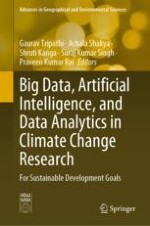
Big Data, Artificial Intelligence, and Data Analytics in Climate Change Research

For Sustainable Development Goals

herausgegeben von: Gaurav Tripathi, Achala Shakya, Shruti Kanga, Suraj Kumar Singh, Praveen Kumar Rai

Verlag: Springer Nature Singapore

Buchreihe : Advances in Geographical and Environmental Sciences

insite
SUCHEN

Über dieses Buch

This book explores the potential of big data, artificial intelligence (AI), and data analytics to address climate change and achieve the Sustainable Development Goals (SDGs). Furthermore, the book covers a wide range of related topics, including climate change data sources, big data analytics techniques, remote sensing, renewable energy, open data, public–private partnerships, ethical and legal issues, and case studies of successful applications. The book also discusses the challenges and opportunities presented by these technologies and provides insights into future research directions.

In order to address climate change and achieve the SDGs, it is crucial to understand the complex interplay between climate and environmental factors. The use of big data, AI, and data analytics can play a vital role in this effort by providing the means to collect, process, and analyze vast amounts of environmental data. This book is an essential resource for researchers, policymakers, and practitioners interested in leveraging these technologies to tackle the pressing challenge of climate change and achieve the SDGs.
Inhaltsverzeichnis

Frontmatter
Chapter 1. Experimental Analysis of Precipitation Forecasting Using Machine Learning and Distributed Machine Learning Approach
Abstract
Weather forecasting plays a significant role in the field of agriculture, energy industry, forestry and provides stable habitat for a wide variety of species. The prediction methods play a vital role in accurate precipitation forecasts. This chapter aims to evaluate the accuracy of rainfall prediction in India through machine learning (ML) techniques like K-Nearest Neighbors (KNN), Decision Tree (DT), Random Forest (RF), and Ada-Boost (AB). The high spatial resolution data like rainfall, maximum and minimum temperature data were collected from all over India from the Indian Meteorological Department (IMD) (6.5 N° & 66.5° E to 38.5° N & 100.5° E). The datasets for validation/training and testing consisted of daily rainfall maximum and minimum temperature from different locations within India from 2018 to 2022. The dataset is represented in the form of a grid, which is arranged in the degree of 1.0*1.0. We have evaluated and compared the machine learning algorithms and distributed machine learning algorithms using Dask-ML. The Dask-ML enables distributed machine learning with data parallelism by efficiently processing extensive datasets across a cluster of machines, scaling workflows and handles large volumes of data. Distributed machine learning algorithms have faster execution.
V. Balaji, M. Sivagami, K. Mohan
Chapter 2. Analysis of Inherent Memory in Hydroclimatic Time Series: Implications for Statistical Tests and Long-Term Data Generation
Abstract
This study delves into the pivotal importance of intrinsic memory within time series data, focusing on hydroclimatic variables and their far-reaching implications for statistical tests and the generation of long-term data. Relying solely on assumptions proves inadequate for accurate analysis; thus, this study underscores the importance of collecting data through long-duration observations, harnessing the power of big data analytics. The spatial distribution of autocorrelation structures in global observed/reference data is thoroughly examined for various hydrometeorological variables, including diurnal temperature range, precipitation, temperature, vapor pressure, wet day frequency, and potential evapotranspiration, drawing from extensive datasets. Our findings reveal that most regions across the world exhibit significant autocorrelation in all these variables, showcasing the potential of big data in enhancing our understanding of hydroclimatic patterns.
Chetan Sharma, Anoop Kumar Shukla
Chapter 3. Intelligent Solutions for Flood Management: Integrating Artificial Intelligence and Machine Learning
Abstract
Floods are the most disruptive natural calamities, significantly affecting agriculture, infrastructure, socioeconomic systems, and human lives. As a result, governments are under pressure to create trustworthy and precise maps of flood risk regions and to further plan for sustainable flood risk management based on prevention, protection, and preparedness. Artificial Intelligence (AI) and Machine Learning (ML) have emerged as powerful tools in addressing the complex challenges of climate change. Numerous applications of AI and ML exist for managing and reducing floods. This chapter deals with the various algorithms of machine learning in early warning systems, flood mapping and modeling, flood forecasting and risk assessment, damage assessment and recovery, social media, and sensor data analysis.
Neha G. Paswan, Litan Kumar Ray
Chapter 4. Artificial Intelligence and Machine Learning-Based Building Solutions: Pathways to Ensure Occupant Comfort and Energy Efficiency with Climate Change
Abstract
Climate change is a global phenomenon and a potential hazard to all communities on the Earth. In climate change context, inadequate building design and the absence of effective building management systems result in miserable living conditions for the occupants and excessive energy consumption. Modern information and automation systems integrated with machine learning (ML)-based prediction algorithms and artificial intelligence (AI)-based controls enhance thermal comfort and energy efficiency in the building sector. The applications, advantages, and limitations of information and automation systems range from facility management systems to cutting-edge digital twins (DT). Therefore, the purpose of this article is to discuss the building industry's information and automation systems in chronological order. The application of the systems is discussed first, followed by the ML-based prediction algorithms and AI-based controls. Finally, the concept of DT and its implementation in the building industry for energy conservation and occupant comfort management are examined in depth. DT is identified as a potential operating system for vast and complex buildings if implementation and standardization gaps are filled.
A. Siva Barathi, Naga Venkata Sai Kumar Manapragada, Praveen Kumar Rai, Satyavati Shukla, Anoop Kumar Shukla
Chapter 5. Deep Learning Models for Fine-Scale Climate Change Prediction: Enhancing Spatial and Temporal Resolution Using AI
Abstract
Climate change prediction is a critical aspect of understanding and mitigating the impacts of global environmental changes. This chapter provides an in-depth overview of deep learning models specifically designed for fine-scale climate change prediction, with a primary focus on improving spatial and temporal resolution. The notion of deep learning and its applicability to studies on climate change are introduced at the beginning of the chapter. It examines the special powers of deep learning models, such as their capacity to draw significant characteristics from massive climate datasets and automatically identify intricate patterns. There is discussion of the application of recurrent neural networks (RNNs) and convolutional neural networks (CNNs) in climate modeling, highlighting their potential in capturing spatial dependencies and temporal dynamics. Data preparation is a crucial component of deep learning models for predicting climate change. The chapter delves into various preprocessing techniques, such as data normalization, feature engineering, and dimensionality reduction, that aid in optimizing model performance. Additionally, the chapter explores downscaling methods that utilize deep learning to enhance the resolution of climate data, enabling more accurate predictions at localized levels. The application of super-resolution mapping using deep learning techniques is also discussed, showcasing its potential in generating high-resolution climate maps from low-resolution inputs. To show the value of deep learning models in fine-scale climate change prediction, a number of case studies and real-world examples are provided. Furthermore, the chapter addresses the performance evaluation metrics and methodologies for assessing the accuracy and reliability of deep learning models in climate prediction. Lastly, the chapter outlines future research directions and potential advancements in deep learning for fine-scale climate change prediction. The chapter concludes by highlighting the significance of deep learning models in advancing our understanding of climate change dynamics and aiding decision-making processes for sustainable environmental management.
Gagan Deep, Jyoti Verma
Chapter 6. Exploring Streamflow Variation in the Subarnarekha River Basin, Jharkhand, India
Abstract
A trend analysis of a river basin’s streamflow and rainfall provides valuable information for the better understanding and sustainable management of water resources for different activities like agricultural industrial, hydropower, etc. In this chapter, trend analysis and abrupt change in streamflow of four gauging stations of Subarnarekha River were explored using Mann–Kendall and Pettitt test for the period (1996–2017: 22 years) on a seasonal and annual basis. The Pettitt test result demonstrates that over the period 1996–2017, none of the hydrological stations showed any abrupt change in streamflow discharge. Muri, Jamshedpur, and Ghatsila gauging stations showed a negative trend in annual and monsoon streamflow discharge, but annual streamflow discharge at Adityapur gauging stations exhibited a positive trend, showing that the river Subarnarekha’s mainstream provides less water than its major upstream tributaries Kharkai. The results of the Spearman correlation coefficient were found significant for annual, monsoon, and post-monsoon seasons between streamflow of basin outlet gauging stations (Ghatsila) and basin rainfall, which reflect Subarnarekha is a unique seasonal river with monsoonal characteristics. Changes in annual and seasonal streamflow regimes may increase the likelihood of future droughts. In light of the findings, efforts should be focused on building a water resource management plan to tackle the possible negative effects of predicted changes in seasonal and annual streamflow regimes.
Shashank Shree, Manoj Kumar
Chapter 7. Geoinformatics-Based Land Degradation Susceptibility Analysis and Sustainability of Palghar Sea Coastal Areas
Abstract
In the present study, an attempt has been made to map the existing coastal resources of Palghar districts to understand the land degradation susceptibility based on various derived thematic maps like administrative boundaries with talukas, topography of the area, contour map, soil classification, geomorphology, and drainage pattern using the geoinformatics tools. In the present work, an attempt has been made to determine the spatial assessment of vulnerability of the Palghar coast land degradation susceptibility and sustainable land use planning of Palghar coastal zone using an integrated approach of geoinformatics, hence to protect the coastal zone from human activities that may cause degradation of coastal land. The ecological and socio-economic aspects are studied by mapping existing resources. The areas affected by coastal erosion, coastal accretion, and wind speed are categorized most vulnerable, moderate, and less vulnerable. Mapping of coastal hazards is essential which includes understanding the flooding and erosion of the coastal zones, in order to protect the people and their property. A coastal regulation zone lines are marked at various levels as low tide line, high tide line, and hazardous line at 700 m. A sustainable land use map is proposed with appropriate sustainable adaptation strategies. In the present study at attempt has been made to prepare a suitability map using multiple criteria decision analysis (MCDA). According to the derived potential suitability map, 49.23% of land are suitable for agriculture, 13.47% of land are for settlement, 26.82% for forest, 2.13% for protected area and 8.35% for recreational activities. The sustainable land management is possible by adopting land degradation mitigation measures to prevent the erosion of sea coastal areas.
Rajeev S. Kale, Alok Porwal
Chapter 8. Climate Change and Maritime Security in the Indo-Pacific Region: A Strategic Approach
Abstract
Climate change is defined as a modification in the typical weather patterns, encompassing factors such as temperature, humidity, rainfall, cloud cover, and wind behavior. This alteration may involve differences in the frequency or intensity of these elements. Throughout the course of human history, the Earth’s climate has undergone periodic fluctuations that span significant durations. There is a consensus within the scientific community that the observed changes cannot be attributed to long-term natural climate cycles. However, it is human activity and the phenomenon of global warming that can be identified as the principal factors contributing to these issues. Maritime security is a relevant topic in international relations, with major actors incorporating it into their mandates or redesigning their work. Three approaches are proposed to understand the commonalities and disagreements associated with the concept of maritime security: semiotics, securitization, and security practice theory. Semiotics reflects the different meanings by exploring the relationship between maritime security and other concepts, while securitization provides a means of understanding how maritime security involves various threats. The purpose of security practice theory is to understand what actions are taken in the name of maritime security. These frameworks play a crucial role in promoting international coordination by delineating various interpretations of maritime security and highlighting political disputes. Currently major actors in maritime policy, ocean governance, and international security have launched ambitious maritime security strategies, including The United Kingdom, The European Union, The African Union, India, Japan, Australia, The U.S., and ASEAN countries. This study will focus on the present situation the whole world is grappling with the problem of climate change and in view of this situation, climate change has emerged as a major problem for maritime security in the Indo-Pacific region, which has a direct impact on health as well as on the economy and the future, it will take an even more formidable form. In this paper, we discussed, what are the major maritime security approaches and methods and their importance in the changing climate. How climate change is impacting the Indo-Pacific region and why is power involving in the Indo-Pacific in the twenty-first century?
Amit Kumar Singh, Aparna
Chapter 9. Climate Change and Renewable Energy
Abstract
Global energy demand continues to increase year after year due to increasing population and technological advancement. More than 50% of energy is produced by conventional sources, which release greenhouse gases resulting in global warming and leading to climate change. Climate change is one of the major concerns all over the world. It adversely affects aquatic ecosystems along with flora fauna and human beings. Economic development and energy demand cannot be compromised so the only way to combat climate change is renewable energy. Harnessing of renewable energy is emphasised all over the world. About 25% of energy demand is harnessed by renewable sources, mostly wind and solar energy. Biomass energy is another renewable source attracting the global eye towards it. Hydroelectric power is also widely harnessed all over the world. Other important renewable energy sources include tidal energy and geothermal energy. There is a great need to develop sustainable economic technology to harness this renewable energy. Tidal energy has great potential to generate electricity, but it may affect the ocean ecosystem. Therefore, there is a great need to develop sustainable technology to harness it. There is a great need to develop technology for harnessing geothermal energy. Renewable energy is the only way to combat climate change. Therefore major objective of the paper is to thoroughly review available renewable energy sources, their capacity, and the gap in harnessing this energy.
Juhi Rani, Juli Kumari, Soubhagya Keshari Chand, Sasmita Chand
Chapter 10. Sustainable Development Goals and the Indian Himalayan Region
Abstract
Development in mountainous regions is a tedious task. Proper planning and execution of development policies, and projects along with the construction of sustainable infrastructure is a necessity. In the Himalayan regions, nature performs a crucial role which cannot be overlooked considering the potentially grave implications. The Indian Himalayan region comprises eleven states and two union territories. Though the government provides this region's growth with significant focus, it is vital to take a look at its accomplishments through the prism of the Sustainable Growth Goals. These goals have been specifically designed to attain development in a holistic way and their role becomes more substantial with respect to the Himalayan region. It is so because these goals can help in combating various social, economic, and environmental issues through sustainable ways. Himachal Pradesh has been ranking second in SDG India Index Reports consecutively for the last two terms. Being a hilly region, it inspires me to understand the importance of SDGs in achieving sustainable development. The present study aims to examine the impact of SDGs on the Indian Himalayan region. In addition, it will not only try to bring forth the areas that need consideration but also try to draw focus on areas that can be used as strengths to attain development sustainably. The present study is an attempt to analyze how SDGs are impacting the development of the Indian Himalayan region and what else shall be incorporated so that every state or union territory of this region can gain benefit and develop under the aegis of Sustainable Development Goals.
Deeksha Rana, Shweta Rana, Seema Choudhary
Chapter 11. Climate Change and Energy Aspects
Abstract
Climate change is a global issue with far-reaching consequences for the environment, society and economy. The shift to renewable energy sources is critical for preventing climate change by lowering greenhouse gas emissions and promoting sustainable development. This study paper presents an in-depth examination of the connection between climate change and renewable energy. It investigates the effects of climate change, investigates the possibilities of renewable energy technology and considers policies and efforts aimed at encouraging the use of renewable/nonrenewable energy. Renewable energy technology has advanced dramatically in recent years, becoming more efficient and cost-effective. Solar panels, which harness the power of the sun to generate electricity, are now more affordable and efficient than ever before. Wind turbines have grown in size and efficiency, collecting wind energy to provide clean power on a huge scale. Hydroelectric and geothermal power facilities create electricity from natural resources without emitting hazardous emissions. In this chapter, we also discuss the obstacles and opportunities of renewable energy integration, as well as successful case studies and future research objectives. Policymakers, researchers and stakeholders may make informed decisions to combat climate change and speed the global transition to a clean and sustainable energy future by understanding the intricate interplay between climate change and renewable energy.
Unni Kisan, S. K. Trivedi
Chapter 12. Mustard Yield Forecast Using Radiation Use Efficiency Method
Abstract
The production of Brassica juncea, often known as mustard, holds significant importance in the field of world agriculture as it serves as a crucial source of edible oil, sauces, and livestock feed. The significance of enhancing mustard crop output and quality has escalated in recent years, primarily driven by the increasing demand for edible oils and the imperative for sustainable farming techniques. This abstract provides a comprehensive evaluation of mustard crop yields, with a particular focus on the use of scientific methodologies and on-site observations to enhance productivity. The research was conducted during the year of 2021–2022, where the estimated yields were compared based on the average yield of three consecutive years (18–20) from the Directorate of Economics and Statistics (DES). The results obtained indicate a variation of around 20% in yield differences across all the districts selected for the study. In order to assess the efficacy of our model, a series of statistical analyses were conducted. The findings revealed a range of correlations between 0.8 and 0.9, as well as R-squared values ranging from 0.54 to 0.82. The root mean square standard error (RMSE) varies from 4 to 21%, whereas the D-values vary from 0.85 to 0.93. The obtained result demonstrates a significant use of the radiation use efficiency model in predicting mustard crop production, hence providing valuable assistance in yield forecasting. The agricultural sector plays a crucial role in the Indian economy, as well as in guaranteeing food security.
Shweta, Praveen Kumar Rai, Ranju Joshi Pandey
Chapter 13. Public–Private Partnership for Climate Change Research
Abstract
Out of the two major factors defining climate change (biogenic and anthropogenic), humans have control to modify only the anthropogenic ones. For anthropogenic as well, the actions for which climate responses are irreversible, cannot be controlled, however, they can be monitored to bring better adaptation from human perspective. For the reversible anthropogenic factors, designing control mechanisms and mitigation strategies requires proper monitoring and investigation of anthropogenic activities through research in various aspects. Now is the time when collaboration is the only way to sustain life on Earth and not this, public–private partnership in the research domain is crucial. Losses due to weather-related events have roughly increased 10 times over the last 40 years and to combat the surmounting losses, accelerated deployment of various research agencies is required. From climate-smart agriculture to climate resilience infrastructure, everything requires extensive research to come up with strategies for decisive actions. This becomes even more important in the case of estimating the indirect emissions, i.e., scope 2 and scope 3 emissions of value chains. Inclusive work of private and public entities, knowledge as well as technology exchange is important. Some of the studies have found that PPPs (public–private partnership) lead to higher outcomes and allow the government to overcome incompleteness of work, besides being time-managed and cost-effective. PPS potentially can provide a useful framework under which both can pool and coordinate more efficiently for the common cause of climate change. Adaptation principles given by the World Bank for designing strategies for climate change adaptation and resilience also underscores the importance of PPPs.
Shweta Singh, Sudhanshu Jangir, Sasmita Chand
Chapter 14. Groundwater and Sustainable Development Goals: Water Table Characteristics in Varanasi City
Abstract
Groundwater, as a vital natural resource, plays a significant role in meeting water demands and promoting sustainable development in urban areas. This study focuses on the groundwater dynamics and water table characteristics in Varanasi city. Varanasi's cultural and historical importance, coupled with rapid urbanization and population growth, has led to increased water demands. Understanding the relationship between groundwater dynamics and the Sustainable Development Goals (SDGs) is crucial for formulating effective water management strategies to ensure water security and sustainable development. However, the over-exploitation of groundwater poses a significant challenge to achieving the United Nations Sustainable Development Goals (SDGs), particularly SDG 6. This study aims to investigate the characteristics of the water table in Varanasi City, with a focus on understanding the impact of over-extraction of groundwater. The study utilizes a combination of field surveys, groundwater monitoring, and hydrogeological analysis to assess the groundwater situation in Varanasi. Water table characteristics and groundwater recharge are calculated to identify trends and challenges related to groundwater availability. Overall groundwater dynamics is also analyzed. Results indicate that Varanasi faces significant groundwater challenges, the water table has experienced a declining trend over the years. To achieve sustainable development goals related to water resources, the study emphasizes the importance of implementing measures for sustainable groundwater management in Varanasi City. Groundwater depletion directly affects SDG 6, which focuses on ensuring clean water and sanitation for all. Furthermore, groundwater is essential for achieving SDG 2 (Zero Hunger) as it supports irrigation for agricultural activities in the region. Groundwater depletion can undermine food security and livelihoods for local communities. By understanding the water table characteristics in Varanasi City and adopting sustainable groundwater management practices, the local authorities and communities can work toward safeguarding this critical natural resource for present and future generations while contributing to the attainment of SDG 6 and other interrelated sustainable development objectives.
Rajpriya, Vinay Kumar Rai
Chapter 15. Approach of Hydrogeomorphological Mapping for Groundwater Resource Management in Mirzapur District, Uttar Pradesh
Abstract
Hydrogeomorphological mapping and analysis provide the clear-cut picture and information about the earth surface and gives a permissible support to understand the regional characteristics to any area. It is a best suited approach to explore the possibility of water resources, especially in semi-arid region where availability of water resources is insufficient especially groundwater. The assessment of quantity of groundwater is essential for regional development especially in hilly terrain. Remote sensing data and GIS techniques of image interpretation have played a very significant role in investigation of the different hydrogeomorphological features that play dominant role and provide basic platform for all sorts of human activities like socio-economic and cultural development. Therefore, mapping and analysis of hydrogeomorphic features are used as robust tool for presenting a clear picture of landforms that may support to access the land capability, agricultural land quality, and groundwater prospects for increasing irrigational facilities. The main focus of the present study is to utilize the knowledge of hydrogeomorphological features for the targeting of groundwater resource for irrigation and drinking water facilities in semi-arid area having heterogeneous terrain conditions like Mirzapur District. Nowadays, remote sensing and GIS techniques have become a modern tool for mapping and analysis of hydrogeomorphic landforms. The Landsat-8 (OLI and TIRS) satellite data is used to demarcate hydrogeomorphological landforms to evaluate groundwater condition of the study area. An integrated remote sensing and Geographic Information System (GIS)-based approach has been used for demarcating groundwater potential zones in the study area.
Ankit Pandey, Nitin Kumar Mishra
Chapter 16. Soil Erosion Assessment of Rohru C.D. Block of Himachal Pradesh Using Geospatial Tools
Abstract
Estimating the extent and severity of soil erosion along with characterizing the soil properties and erosion factors is crucial for understanding and addressing detailed analysis of soil conditions in a given area. In this regard, the application of technology and tools like Remote Sensing and GIS are used to collect, analyze, and visualize data related to the Earth’s surface and its features that has a potential significance. An attempt has been made to estimate soil erosion employing (RUSLE) in the current study the Rohru Community Development Block, with an aerial extent of 305.57 km2, and a GIS-based physical resource database has been created to get a glance of physical-based information. Thematic maps have been created utilizing IMD data, NBSS/LUP, DEM, satellite imageries, and NDVI to access the research areas soil loss risk zone. These maps include different factors employed in RUSLE (rainfall erosivity, soil erodibility, slope length, slope steepness, land cover management, and conservation strategies). High-resolution satellite data of 5 m and DEM of 12.5 m were used to generate LULC and slope layer. Using GIS-based overlay analysis, all thematic layers have been analyzed and combined. It was concluded that around half of the total geographical area of block fall under extensive soil loss category and only a total of 27 percent of the region was covered under the moderate and low soil loss category. The study shall be useful for further planning and can be used as quick guide for further studies.
Ajay Chanjta, D. D. Sharma, Naina Sambher
Chapter 17. Impact of Sarangkheda Dam Construction on the Downstream Reach of Tapi River of Nandurbar District, Maharashtra
Abstract
This study has investigated the impact of Sarangkheda Dam construction on the downstream reach of the Tapi River since 1985. From the Sarangkheda Dam to the Sarangkheda Gauging Station, close to Sarangkheda Village in the Nandurbar District of Maharashtra, the study extent is 8.5 km long. This study describes changes in water discharges, sediment loads, mean channel-bed elevation, bed degradation, and channel width downstream from the Sarangkheda Dam constructed on the Tapi River. The construction of the Sarangkheda Dam in the Nandurbar District of Maharashtra involved utilizing geographic information system (GIS) analysis, which focused on a time series of Landsat satellite images obtained in 1996, 2006, 2010, and 2019. The primary objective of this analysis was to assess the variations in the width of the non-vegetated active channel, bed elevation, and sediment load of the Tapi River profile. From 17.48 cubic meters in billion in 2006 to 3.28 cubic meters in billion in 2014, the yearly flow volume dropped. Following the construction of the Sarangkheda Dam, the yearly flow volume from pre-dam to post-dam averaged 5.93 cubic meters in billion across the downstream, and from 1985 to 2014, the reach's mean bed elevation decreased from 112.74 to 111.35 m. The 8.5 km length downstream of the Sarangkheda Dam should be most affected by the changes in bed elevation. The Sarangkheda Dam typically reduced flood peaks. However, because a large volume of water is discharged when the dam releases water, other aspects of the post-dam water discharge characteristics change from time to time. The degree of bed erosion in the river channel ranged from little to about 1.25 m over the 8.5 km length downstream of the Sarangkheda Dam cross sections that were studied. Typically, most of the decrease occurred post to the construction of the dam. The channel width in the downstream reach of Sarangkheda Dam can undergo changes, including increases, decreases, or maintaining a constant width. When confronted with considerable variability, the temporal alterations in streambed elevation and channel width at a specific location may frequently be elucidated by analyzing cross-sectional data and satellite imagery.
Manas Utthasini, Priyanka Dasgupta
Metadaten
Titel
Big Data, Artificial Intelligence, and Data Analytics in Climate Change Research
herausgegeben von
Gaurav Tripathi
Achala Shakya
Shruti Kanga
Suraj Kumar Singh
Praveen Kumar Rai
Copyright-Jahr
2024
Verlag
Springer Nature Singapore
Electronic ISBN
978-981-9716-85-2
Print ISBN
978-981-9716-84-5
DOI
https://doi.org/10.1007/978-981-97-1685-2