2023 | Buch

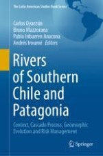
Rivers of Southern Chile and Patagonia

Context, Cascade Process, Geomorphic Evolution and Risk Management

herausgegeben von: Carlos Oyarzún, Bruno Mazzorana, Pablo Iribarren Anacona, Andrés Iroumé

Verlag: Springer International Publishing

Buchreihe : The Latin American Studies Book Series

insite
SUCHEN

Über dieses Buch

This book provides a comprehensive analysis of the evolution of rivers affected by natural and anthropogenic disturbances in the southern Chile and Patagonia. It presents a detailed description of the rivers affected by climatic extremes, volcanic eruptions, large-wood dynamics and impacts, sediment-laden flows, and Glacier Lake Outburst Floods (GLOFs). Moreover, it contains an in-depth discussion of a variety of topics encompassing the ecosystem function of Pacific Patagonia rivers, the geomorphic signatures of Glacier Lake Outburst Floods (GLOFs) and their impacts within river corridors, as well as the assessment of the associated natural hazards and risks. Further, it provides proposals for public and territorial policies that improve the management and sustainable strategies of the hazards and risks.

This book is conceived by leading researchers of the Universidad Austral de Chile and includes contributions by distinguished scholars from around the world. It attracts a wide range of readers, including scientific community, researchers, undergraduate and graduate students, and policy makers from Chile and abroad.
Inhaltsverzeichnis

Frontmatter
Chapter 1. An Introduction to the Rivers of Southern Chile and Patagonia
Abstract
The rivers of southern Chile and northern Patagonia (39–47° S) are located in a region affected by natural disturbances, such as climatic extremes (high variability of rainfall), retreat of glaciers, large volcanic eruptions, glacial lake outbursts of floods, seismic activity, and frequent landslides. Annual precipitation records show great differences in the region. In general, there is a decrease in precipitation from north (39° S) to south (47° S), and Patagonia region shows a strong E-W gradient, with the driest areas in the Andes mountain areas and the wettest on the coast. In general terms, there are strong differences between the discharge of the rivers in southern Chile and Patagonia. The discharge of the last ten years (2011–2020) shows a slight downward trend in all rivers.
Carlos Oyarzún
Chapter 2. Landscape Disturbance and Ecosystem Function of Pacific Patagonia Rivers
Abstract
The rivers of southern Chile may be characterized by high specific discharge and extreme gradients in elevation, geography and climate over short trajectories. Major rivers are often transcordilleran, passing through cold-steppe to deciduous sub-Antarctic to evergreen temperate rainforest ecoregions, supplemented by glacial inflows or buffered by large mid-catchment lakes, all within relatively unimpaired or nearly pristine landscapes. As a consequence, instream disturbance regimes, a driver of ecosystem function in rivers, are expected to vary widely as a consequence of diversity of natural flow disturbance and sediment regimes over short distances and complex hydrologic networks. Superimposed on these base-line fluvial disturbance patterns are geologic disturbances such as landslides, deposition of volcanic ash, and floods triggered by extreme climatic events or glacial lake outburst events. Another characteristic of Patagonian southern Andes is that these otherwise discrete extreme events may nevertheless be concentrated or superimposed within confined areas of the hydrologic landscape. Discussed are some of the potential consequences of natural disturbance regimes, both base-line and extreme events. A conceptual model of ecosystem development and resilience across coupled terrestrial and aquatic systems affected by disturbance pulses is presented. Ecosystem function within hydrologic networks is expected to vary widely over short spatial scales, while the potential ecosystem consequences of extreme events is expected to significantly alter the export of energy, nutrients, materials and weathering substrates and to downstream systems such as lakes and extensive inland marine ecosystems of southern Patagonian fjords.
Brian Reid, Anna Astorga
Chapter 3. San Pedro River: A Biological and Cultural Treasure in Northern Patagonia
Abstract
Northern Patagonian River systems located between the Araucanía and the Los Lagos Regions of Chile are characterized by lake regulation and seasonal predictable flow regime. As these systems originate in large glacial lakes, their flow velocities are lower compared to other Andean River systems in Chile. The San Pedro River (Valdivia River basin) is an iconic largely pristine northern Patagonian River system characterized by rich hydrogeomorphology and biodiversity as well as unique paleontological and human histories. It originates from a chain of eight lakes that generate lacustrine influence in upper zone, followed by a middle section with high slope and flow velocities, lower reaches with developed floodplains, to discharge to the Pacific Ocean in Valdivia Estuary. Consequently, this river system in a stretch of just 100 km accommodates the highest diversity of freshwater fish species in Chile. The paleontological record along San Pedro River system is also highly relevant with fossil deposits found in sedimentary rocks originating between Triassic and Quaternary periods that have allowed historical climate and vegetation reconstructions. Besides, the strongest earthquake registered worldwide in 1960 in this region directly affects the river and human population which has generated respect for nature. In this way, geological history, fossils, and present biodiversity are input to protect the territory from potential threats.
Nicole Colin, Konrad Górski, Juan José Ortiz, Pablo Iriarte, Ana M. Abarzúa
Chapter 4. Large Wood Research and Learning in Chile
Abstract
Large wood (LW, wood pieces with diameter ≥ 10 cm and length ≥ 1 m) is present in rivers as individual elements or forming accumulations. During the 1970s, the study of LW in rivers began to be massified in the USA, mainly in the assessment of its effect on fish (Swanson et al., Earth Surface Processes and Landforms 46:55–66, 2021). It is essential for the protection and restoration of aquatic ecosystems and geomorphological stability. In Chile, the first studies began in 2005 in mountain basins. Subsequently, studies are carried out on the contribution of LW and its impact after volcanic eruptions (Chaitén and Calbuco volcanoes). Among the results in Chile stand out: in Andean basins, LW volumes are very abundant, comparable to data from the Pacific northwest of North America; the amounts of LW are very variable between basins, because of the characteristics of the riverine forest and the level of alteration in forest basins; between 0 and 28% of annual mobility have been determined. In addition, volcanic eruptions can generate large LW inputs and mobility between 42 and 94%. Monitoring can be done from fieldwork, satellite imagery and lately using UAV flights. These learnings have made it possible to understand the role of LW and the processes involved. However, there is still a lack of studies for a better understanding of the processes, and on the other hand, disseminating the benefits and risks associated with LW.
Héctor Ulloa, Andrés Iroumé
Chapter 5. River Water Characteristics After Recent Volcanic Eruptions in Southern Chile
Abstract
Within 9 days after recent volcanic eruptions in southern Chile (Cordón Caulle, Villarrica and Calbuco), we analysed the physico-chemical quality of riverine waters of nearby rivers. Sulphates, total suspended solids, fluorides and conductivity were higher at the turbid waters of affected rivers, while pH and silicates showed no significant differences between affected and non-affected rivers. The results of principal component analysis demonstrate a similar overall impact in all affected riversheds, independently of the volcanological characteristics of the erupting centres.
Eduardo Jaramillo, Alexandre Corgne, Aldo Hernandez
Chapter 6. Deciphering the Morphologic Change in the Radial Drainage System of the Calbuco Volcano Caused by the 2015 Eruption
Abstract
The eruption of the Calbuco volcano on April 22, 2015 presented three eruptive pulses, the second eruptive pulse being the main responsible for the most considerable impacts both in the natural and anthropic environment. This pulse generated several lahars due to the interaction of pyroclastic flows with glaciers and snow close to the summit of the volcano, causing alterations in the morphology of the volcano’s radial drainage system. The most affected basins were those of the Blanco Este, Tepu, Blanco Sur y Este rivers, altered by the lahars´ geomorphic work resulting in a remarkable river widening on alluvial deposits and producing geomorphic changes in the typology and configuration of several rivers reaches. To retrace the geomorphic changes occurred in the Blanco Este, Tepu and Blanco Sur rivers, the IDRAIM method was used, which allows for a thorough hydro-morphological analysis encompassing the rivers past geomorphic evolution, the characterization of their current dynamics and the exploration of their possible future trajectories. Following this method, river basins were characterized according to their physiography, then the rivers were segmented into river reaches based on their confinement, their geomorphic units and hydro-morphological typologies were identified by calculating a set of geomorphic indices and morphometric parameters. With this information we assessed the geomorphic signatures left in the affected rivers by comparing the elaborated cartographies referring to the geomorphic configurations before and after the eruption, respectively. The affectation of the basins occurred mainly in the headwaters, generating remarkable changes, thus altering the geography of the place. The basins of the Blanco Este, Tepu, Blanco Sur, and Este rivers were the ones that suffered the greatest degree of alteration featuring on average wider active channels and an increased braiding tendency in the lower water courses. These rivers, affected by large sediment injections, will most probably continue to exhibit major adjustments in the years to come.
Christopher Sepúlveda, Bruno Mazzorana, Héctor Ulloa, Andrés Iroumé
Chapter 7. Investigating the Geomorphological Footprint of Moraine-Dammed Lake Failures in Patagonian Rivers
Abstract
Recent studies highlighted that Glacier Lake Outburst Floods (GLOFs) can profoundly alter the geomorphology of affected rivers. Attempting to quantify the geomorphic changes generated by recently occurred GLOF events, in this study we systematically compared a set of affected with another set of unaltered rivers in Chilean Patagonia. First, we performed a discriminant analysis on specific basin characteristics assuring that the two sets of river systems shared similar morphological characteristics. Once the basins of unaffected control rivers exhibiting a high degree of morphological similarity were selected, we carried out specific steps of the IDRAIM methodology based on multi-temporal areal images, thereby identifying the typology and dominant morphology of both groups of rivers, discerning among the affected ones the pre- and post-event conditions. This classification was based on the sinuosity (SI), braiding (BI), and confinement index (CI) parameters. Subsequently, an ANOVA analysis of the index values was performed. The obtained results showed that the affected rivers exhibited a higher BI than the unaffected ones. Conversely, no significant differences in the SI values could be detected between the two groups of rivers. Regarding confinement, the affected rivers featured on average larger flood plains and significantly greater active channel widths due to the “sweeping” effect that these high energy processes exerted on the different morphological units of the river corridor. Summing up, this study corroborated the role of a sudden drainage of glacier lakes as a potent geomorphologic agent. In the context of ongoing climatic change and intensifying human impacts, these transient river systems are particularly prone to acute flood risks. Targeted actions should be taken to reduce the adverse effects of GLOF events.
Diego Bahamondes, Bruno Mazzorana, Pablo Iribarren Anacona, Héctor Ulloa
Chapter 8. Cascading Impacts of GLOFs in Fluvial Systems: The Laguna Espontánea GLOF in Patagonia
Abstract
The sudden drainage of glacial lakes (GLOFs) can result in high-energy flows with dramatic geomorphic consequences. GLOFs can erode consolidated river terraces and even bedrock and may generate thick valley aggradation changing rapidly the landscape of fluvial corridors. In Patagonia, GLOFs seem to be increasing in frequency since the 1980s and have affected dozens of rivers. Although a sound understanding of GLOF dynamics and geomorphic consequences is needed to better manage fluvial corridors and mitigate glacier hazards, the geomorphic consequences of GLOFs have been analysed in just a few cases in Patagonia. Here, we report an exceptional river blockage caused by a GLOF in October 2018 in one of the valleys most visited by tourists in the Chilean Patagonia. We describe the geomorphic consequences of the GLOF and reconstruct its dynamics through interpretation of drone images, digital surface models, and the analysis of meteorological and geomorphic data. The GLOF was triggered by a rock-avalanche that impacted a small moraine-dammed lake resulting in a rapid flow (≥ 10 m/s) with competence to transport boulders coarser than 20 m in diameter dozens of metres downstream. The sediment-laden flow impacted perpendicularly the Exploradores Valley damming the Norte River. This resulted in a new lake with a surface of 0.26 km2 and deeper than 6 m that flooded grass land, forest and the tourist route to Exploradores and San Rafael Glaciers. This processes cascade shows that even low magnitude GLOFs (60 × 103 m3) can cause extensive and long-term impacts in fluvial systems.
Pablo Iribarren Anacona, Catalina Sepúlveda, Jorge Berkhoff, Ivan Rojas, Valeria Zingaretti, Luca Mao, Bruno Mazzorana, Gonzalo Durán
Chapter 9. Improving the Channel Network Management After a Large Infrequent Disturbance, Taking Advantage of Sediment Connectivity Analysis
Abstract
Chile is frequently affected by different natural hazards that are constantly reshaping the landscape. Particularly, Large and Infrequent Disturbances (LIDs) such as wildfires and volcanic eruptions are capable of affecting entire river catchments by altering the hydrological cycle, reducing the land cover, and boosting sediment remobilization. Given the multitude of effects caused by such disturbances, the response of the catchments is not easily predictable, and different geomorphic responses are expected. The assessment of sediment connectivity can help to better comprehend the overall effects of wildfires and volcanic eruptions on the sediment transfer dynamics at the catchment scale. Sediment connectivity infers the potential transfer of sediment between compartments of the catchment according to the spatial configurations and the processes of such compartments. After a LID, awareness of the degree of linkage between sediment sources and downstream areas is pivotal to reduce the risk and hazard, improving catchment management. In Chile, analysis of sediment connectivity is extremely valuable even tough the availability of high-resolution topographic data and catchments’ accessibility are not always guaranteed. For this reason, much effort should be employed to adapt approaches, based on high-resolution data, to this context by exploiting freely available global data and satellite images and to find trade-offs between data requirements and reliability of the outcomes.
Lorenzo Martini, Lorenzo Picco, Marco Cavalli, Andrés Iroumé
Chapter 10. Mitigating Complex Flood Risks in Southern Chile in a Particular Spatial Planning Context: Towards a Sustainable Strategy
Abstract
Effectively mitigating flood risk in fluvial environments in Chile characterized by intense volcanism, cryosphere changes, high relief energy and influenced by multiple disturbances, is particularly challenging, and strategies developed in different contexts such as the European Alps might not be directly transferrable to the Chilean setting. But planning and acting in dire straits might also bring about novel approaches to tackle wicked problems. Here, rather than adopting mitigation concepts that showed, under more favourable conditions, to be only partially effective elsewhere, we discuss a bottom up, participatory approach that aims at holistically achieving flood mitigation facing compound limitations. This approach entails the creation of an inclusive risk culture that could enable anticipated action avoiding settlement expansions that may irreversibly increase exposure and diminish the available management options. In the context of a foresighted spatial planning, we propose sustainable innovative solutions that can achieve substantial risk mitigation effects through a targeted interaction with the hazard processes, rather than aiming at preventing their occurrence. It is argued that a wise fusion of direct and indirect mitigation measures planned in a truly participatory way, constitutes, in the long term, the basis for a sustainable future for societies living in risk prone areas in Southern Chile.
Bruno Mazzorana, Francisco Maturana
Chapter 11. Cascading Processes and Multiple Hazards and Risks in Chilean Rivers: Lessons Learnt and Remaining Challenges
Abstract
Characterized by pronounced seismicity, intense volcanism, high relief energy, and cryosphere changes, the Chilean climate, geology, and topography determine the suite of landscape-forming processes and disturbances that under certain circumstances may lead to extreme impacts on society, environment, and infrastructures. Earthquakes, volcanic eruptions, and floods are processes that naturally collide in Chilean river basins, producing process concatenations or cascades and resulting in complex multi-hazards and risks. This calls for a perspective shift, aiming at a multi-hazard approach that goes beyond the simple overlay of multiple single hazards to an approach that also considers interactions between these hazards and risks. In this chapter, we discuss how individual processes or disturbances may interact acting together to form cascades, using case studies from Chile (e.g. rivers affected by volcanic eruptions), and how the resulting hazards and risks could be assessed by integrating all aspects of hazard interactions together with exposure and vulnerability.
Virginia Ruiz-Villanueva, Bruno Mazzorana, Diego Bahamondes, Iván Rojas
Backmatter
Metadaten
Titel
Rivers of Southern Chile and Patagonia
herausgegeben von
Carlos Oyarzún
Bruno Mazzorana
Pablo Iribarren Anacona
Andrés Iroumé
Copyright-Jahr
2023
Electronic ISBN
978-3-031-26647-8
Print ISBN
978-3-031-26646-1
DOI
https://doi.org/10.1007/978-3-031-26647-8